
PC Platinum Viewer & PC Planner
Project Overview
Detailed Description
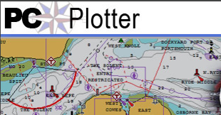
This is a viewer for Navionics Platinum data which contains Map display, Aerial photos, Panoramic Photos, 3D View, Services related database, Tide and current Data. Navionics main business is to sell Cartographic electronic marine charts that are used by various different Plotter manufacturers like Raymarine, Humming bird, Furno, Lowrance and North Star to name few.
In order to test the data generated and also to display the cartography on laptops and in boat shows they needed a windows application that can display all the capabilities. PC platinum viewer was the application that I and my team (4 members) developed. A product was made out of this concept targeting the Laptop market called pcplotter
Key Technologies
Challenges & Solutions
Supporting Different plotters and different GPS hardware.